Last updated · 2026-09-26
A short, steep trail to the view over the lake.
The trail starts near the dam and ends on a steel platform above the water. It is steep in places but short, and you don’t need any hiking experience.
How hard is the Mount Gamti hike?
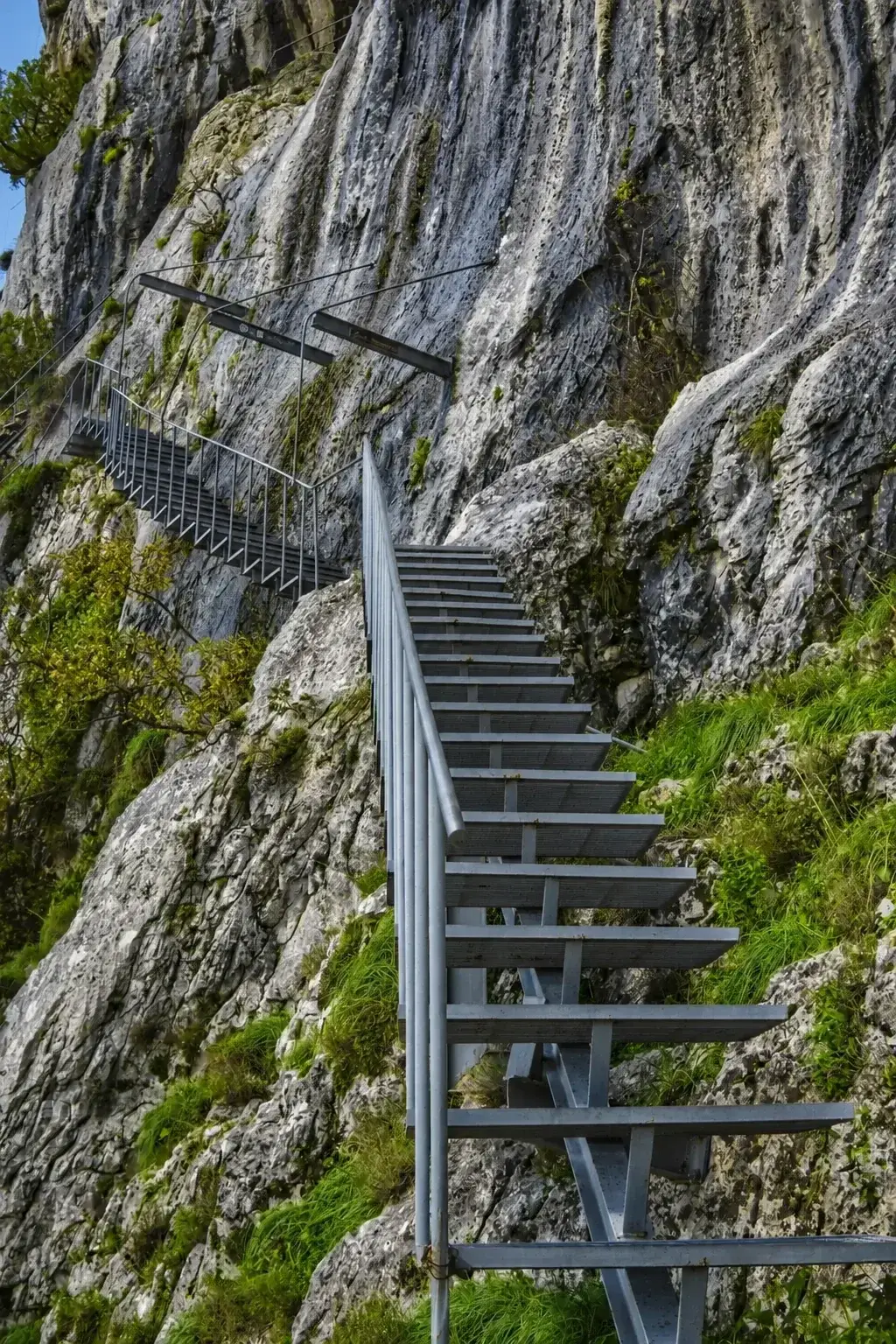
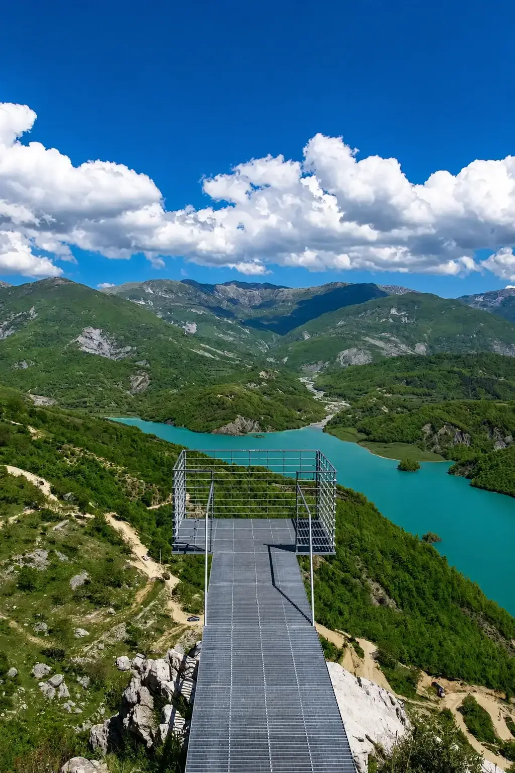
Mount Gamti rises to about 1,268 m, but the hike doesn't go to the peak. It climbs to the Balcony of Bovilla viewpoint at roughly 620 m. It is short and beginner-friendly: about 1.0 km one way, 160 m of elevation gain, and 35–45 minutes to the top. The trail is loose gravel and rocky steps, rated easy-to-moderate, so wear grippy shoes. The final climb uses bolted metal stairs to a viewing platform above the reservoir.
Sources: UKT, Tirana's water utility, Dajti National Park (AKZM), Lake Bovilla, Wikipedia
- Distance
- 1.0 km
- one way
- Elevation gain
- 160 m
- rocky steps
- Duration
- 35–45 min
- to the viewpoint
- Difficulty
- Easy–Mod.
- decent shoes required
The metal stairs at the top
The last part of the climb is a set of metal stairs bolted into the rock. If you are afraid of heights, stop at the restaurant level, where the view is almost as good.
The reward
From the platform you see the whole reservoir and the green valleys below it. On a clear day you can see across to the eastern side of Dajti and, faintly, the hills toward Krujë.
How hard is the Mount Gamti hike?
Easy to moderate, and shorter than most people expect. There are three sensible turning points, so you can decide how far to go once you see the trail rather than committing in advance.
- Level 1 · no climb The dam and the canyon Flat ground at the reservoir edge, plus the bridge over Bovilla Canyon on the way in. No ascent at all, and still the two photographs most people come for. Fine for anyone with a pushchair or limited mobility.
- Level 2 · 25 min Up to the restaurant A steady rocky path gaining roughly 60 m. Almost the full panorama over the reservoir, a place to sit, and no exposure. This is the sensible stop with small children or if the heat is fierce.
- Level 3 · 35–45 min The Balcony of Bovilla 160 m of ascent over about 1 km, finishing on metal stairs bolted into the rock. Not technical, but it is steep near the top and exposed. Skip the final stairs if heights bother you; the view from the restaurant level is close enough.
Is there a restaurant at Lake Bovilla?
Bovilla Restorant sits at the halfway point of the trail, roughly 25 minutes up, with glass walls and a panorama across to Mount Dajti. The menu is traditional Albanian: charcoal-grilled lamb, qofte, salads and chips, mains around €8–12. Two things to know before you count on it: it is cash only, and vegetarian choices are thin. It is also the sensible turning point if the heat is fierce or you are walking with small children.